File:LO-map-Elsweyr (PGE1).jpg
The UESPWiki – Your source for The Elder Scrolls since 1995
Size of this preview: 765 × 600 pixels. Other resolution: 800 × 627 pixels.
Original file (800 × 627 pixels, file size: 215 KB, MIME type: image/jpeg)
Summary[edit]
.jpg&action=edit§ion=1)
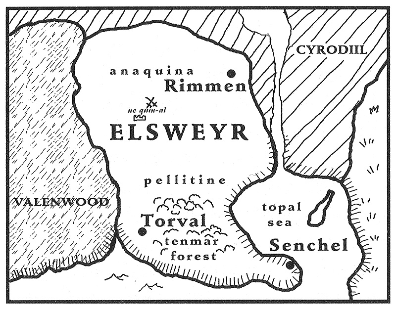
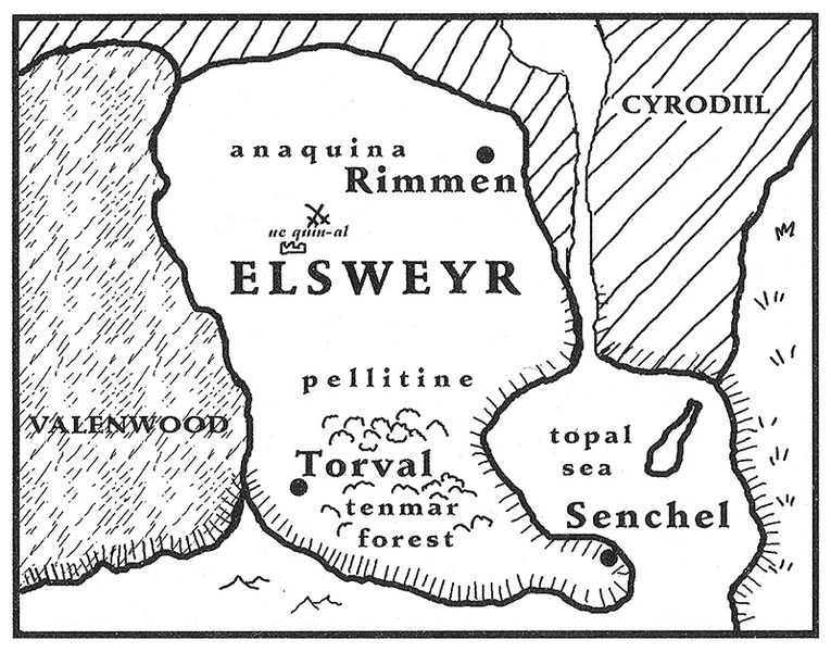
A map of the Elsweyr Confederacy as it appeared in the late Second Era, created by Hugh Riley for the first Pocket Guide to the Empire.
Licensing[edit]
.jpg&action=edit§ion=2)

|
This image was taken from the Elder Scrolls series of video games or from websites created and owned by Bethesda Softworks, the copyright of which is held by Bethesda Softworks. All trademarks and registered trademarks present in the image are proprietary to Bethesda Softworks, the inclusion of which implies no affiliation with the UESP. The use of images to illustrate articles concerning the subject of the images in question is believed to fall under the fair dealing clause of Canadian copyright law. |
File history
Click on a date/time to view the file as it appeared at that time.
| Date/Time | Thumbnail | Dimensions | User | Comment | |
|---|---|---|---|---|---|
| current | 03:46, 22 October 2023 | | 800 × 627 (215 KB) | Babebeforewolves (talk | contribs) | Higher quality |
| 09:33, 24 January 2011 | 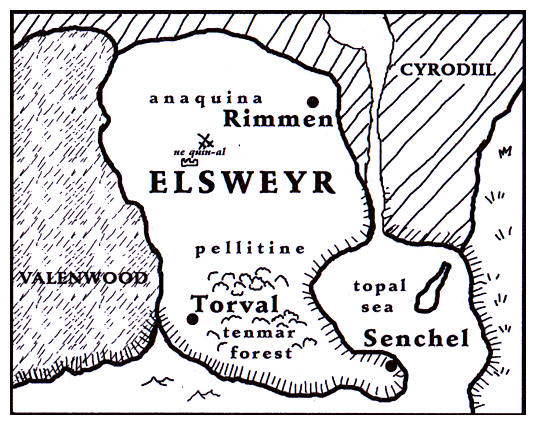 | 536 × 425 (79 KB) | Rpeh (talk | contribs) | Map of Elsweyr from PGE1 Elsweyr |
- You cannot overwrite this file.
File usage
The following 5 pages link to this file:
.jpg&oldid=2912029)
.jpg)
.jpg&action=edit&redlink=1)
.jpg&action=edit)
.jpg&action=history)
.jpg)
.jpg)
.jpg&printable=yes)
.jpg&oldid=2912029)
.jpg&action=info)
.jpg&mobileaction=toggle_view_mobile)